At about 1600 metres, the snow is just barely sticking. Looking up from below, this elevation displays itself as a distinct snow line.
or ... "Now and Then Slocan." Photos and outdoors information from the Slocan Lake area in the southern interior of British Columbia, Canada
Showing posts with label Winter. Show all posts
Thursday, September 26, 2013
Wednesday, September 25, 2013
Winter up here
Past a certain point in September or October, you can usually find winter somewhere if you climb high enough. Today that was Idaho Peak, overlooking New Denver, at just over 2100 metres.
Monday, February 18, 2013
Hills Nordic Trail loops on Reibin Rd.
Hills Nordic Trail Loops on Reibin Rd.
Distance: ~4-5 km (2-3 mi) depending on route
Route type: Multiple loops
Suitable for: XC Skiing
Elevation change: 26 metres up, 26 metres down
Technical difficulty rating: 


Navigational difficulty rating:


About half the local kids seem to participate in XC ski lessons in the winter. Classes run for about 8 weeks along the groomed trails in Hills. This year there are three different age-groups. The older group trains on the groomed system of trails off Reibin Road.
These trails are a busy network of flat and rolling loops with a few optional technical sections. While a first-timer may have some difficulty navigating the trails, they are so tightly coiled together that it is hard to get lost: within a couple of minutes you'll end up somewhere familiar and find your way to wherever you're hoping to go.
To access the trails, park near the carport halfway along the road above Elvendel Farm. The farm is privately owned by a XC ski family who help maintain the trails and lend skiers access across and within their property. Please be respectful, and mind the goats if they're about!
There is a hand-drawn map of the trail system on a piece of corrugated plastic at the top of the driveway, and trails are usually beautifully groomed. Most are groomed wide enough to allow for skate-skiers.
From the road you can head down, to the left or to the right. Most people start out skiing towards the left. After a short flat section you head gradually downhill and arrive at a flatter four-way cross-roads of trails. Straight ahead will take you to a sunny promontory above the gravel pit where the views are beautiful. A left turn will take you alongside a fence and then to a tiny almost-circular flat loop in a meadow. It's worth exploring the entire network.
Distance: ~4-5 km (2-3 mi) depending on route
Route type: Multiple loops
Suitable for: XC Skiing
Elevation change: 26 metres up, 26 metres down
Navigational difficulty rating:
About half the local kids seem to participate in XC ski lessons in the winter. Classes run for about 8 weeks along the groomed trails in Hills. This year there are three different age-groups. The older group trains on the groomed system of trails off Reibin Road.
These trails are a busy network of flat and rolling loops with a few optional technical sections. While a first-timer may have some difficulty navigating the trails, they are so tightly coiled together that it is hard to get lost: within a couple of minutes you'll end up somewhere familiar and find your way to wherever you're hoping to go.
To access the trails, park near the carport halfway along the road above Elvendel Farm. The farm is privately owned by a XC ski family who help maintain the trails and lend skiers access across and within their property. Please be respectful, and mind the goats if they're about!
There is a hand-drawn map of the trail system on a piece of corrugated plastic at the top of the driveway, and trails are usually beautifully groomed. Most are groomed wide enough to allow for skate-skiers.
From the road you can head down, to the left or to the right. Most people start out skiing towards the left. After a short flat section you head gradually downhill and arrive at a flatter four-way cross-roads of trails. Straight ahead will take you to a sunny promontory above the gravel pit where the views are beautiful. A left turn will take you alongside a fence and then to a tiny almost-circular flat loop in a meadow. It's worth exploring the entire network.
Saturday, February 16, 2013
Tuesday, February 12, 2013
Sunday, February 10, 2013
Hills Nordic Rail Trail
Distance: 10.75 km (6.68 mi).
Route type: Out-and-back
Suitable for: XC Skiing
Elevation change: 70 metres up, 70 metres down
Technical difficulty rating: 


Navigational difficulty rating:


A beautiful, easy ski alongside Bonanza Creek. Turn west off Highway 6 in Hills (about 12 km north of New Denver) on Reibin Road, drive 400 metres to the end of the road and veer right onto a little spur called Huckleberry Road, which ends shortly thereafter in a parking area with a generous turnaround. Access to the rail trail is via a 20-metre pathway on the left side of the parking area. Gear up at the bottom of the slope.
The trail extends in two directions. To the south (left) it falls away with a ~3% grade for about 1.3 kilometres before reaching a precipitous hill where judicious skiers normally stop, turn around and head back. To the north (right) it climbs with a 1-2% grade for many kilometres, with the first 3.5 kilometres being groomed regularly by the lovely movers and shakers at the Hills Nordic Ski Club. The trail is well worth skiing in both directions, though the northerly direction as far as "the red house" (a falling-down shack was once painted barn red) is particularly attractive and easy to ski.
The trail runs pleasantly straight while beautiful Bonanza Creek meanders in and out of view to the west. The running water gives a zen-like ambience for those who choose to linger and glide. The tracks of coyote, deer, elk, hare and moose are commonly seen, with moose tracks likeliest to be found in the bermed area that runs through the marshy region on both sides of the red house.
Distance: 10.75 km (6.68 mi).
Route type: Out-and-back
Suitable for: XC Skiing
Elevation change: 70 metres up, 70 metres down
Navigational difficulty rating:
The trail extends in two directions. To the south (left) it falls away with a ~3% grade for about 1.3 kilometres before reaching a precipitous hill where judicious skiers normally stop, turn around and head back. To the north (right) it climbs with a 1-2% grade for many kilometres, with the first 3.5 kilometres being groomed regularly by the lovely movers and shakers at the Hills Nordic Ski Club. The trail is well worth skiing in both directions, though the northerly direction as far as "the red house" (a falling-down shack was once painted barn red) is particularly attractive and easy to ski.
The trail runs pleasantly straight while beautiful Bonanza Creek meanders in and out of view to the west. The running water gives a zen-like ambience for those who choose to linger and glide. The tracks of coyote, deer, elk, hare and moose are commonly seen, with moose tracks likeliest to be found in the bermed area that runs through the marshy region on both sides of the red house.
Sunday, January 13, 2013
Saturday, December 29, 2012
Monday, April 4, 2011
Sunday, April 3, 2011
Sunday, February 20, 2011
Saturday, February 19, 2011
Foul weather blowing in
Weather comes from the west here. Which means we see storms coming "from the Valhallas," meaning from the Valhalla mountain range on the west side of the lake. When the Valhallas start to disappear in clouds of precipitation you have just a few minutes to take cover.
Friday, February 18, 2011
Tuesday, February 15, 2011
Public Pier
Unused through the winter, the public pier was covered in deep snow. Now milder temperatures and the lake's perpetual heat-sink effect are causing the snow to melt in patches.
Monday, February 14, 2011
Sunday, February 13, 2011
Saturday, February 12, 2011
Pet icicle
We get quite fond of certain icicles. This one at our favourite café is our current pet. It's well over a metre long and has grown a little every time we check on it.
Friday, February 11, 2011
Ski Hill Perspective
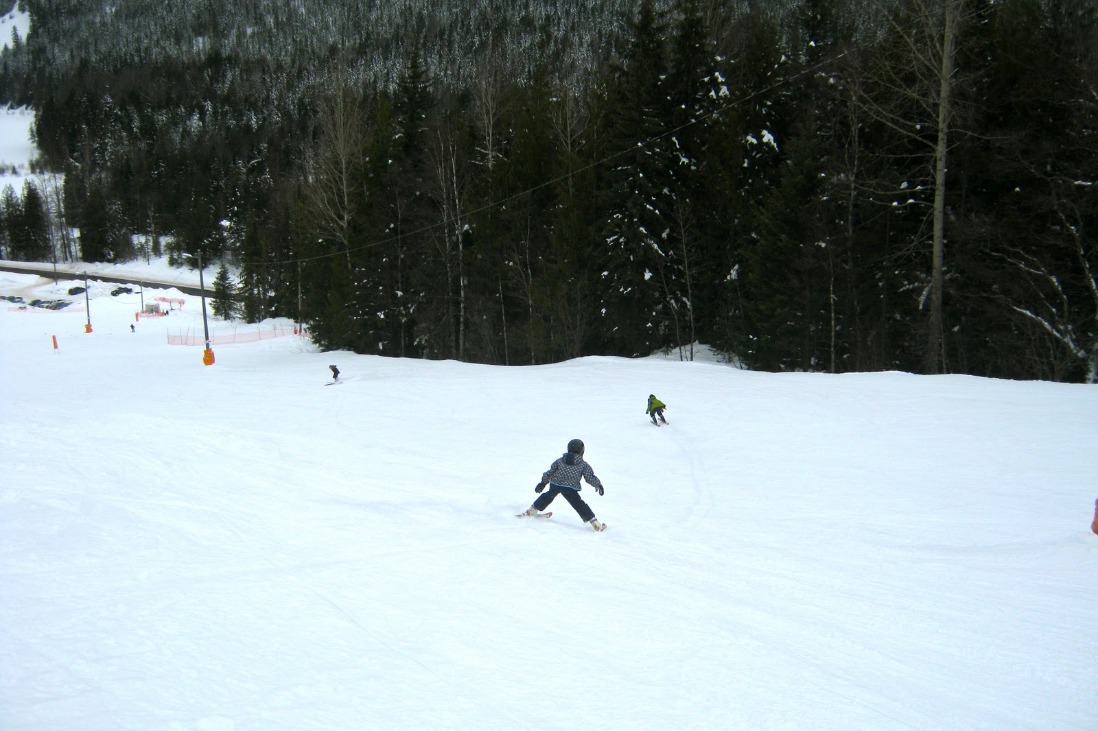
Putting perspective not on the size of the hill, or the view of the base area, but on the size of the operation. On a beautiful day in February with fabulous snow conditions and finger-and-toe-friendly temperatures, you can count nine cars in the parking lot, and the only four skiers you can see in this photo are the four I brought with me.
Thursday, February 10, 2011
Ski Hill View
Looking down on Summit Lake, which marks the northern end of the Slocan Valley, from part way down the southernmost easy ski run.
Wednesday, February 9, 2011
Subscribe to:
Posts (Atom)