At about 1600 metres, the snow is just barely sticking. Looking up from below, this elevation displays itself as a distinct snow line.
or ... "Now and Then Slocan." Photos and outdoors information from the Slocan Lake area in the southern interior of British Columbia, Canada
Showing posts with label Mountains. Show all posts
Thursday, September 26, 2013
Saturday, September 14, 2013
A question of scale
It might look like a nondescript photo of a trail with a bit of snow and moss, but it's actually a photo of a creekbed in a high alpine basin, taken with a zoom lens from a nearby summit. There's a girl in the photo, at about 2 o'clock.
Friday, September 13, 2013
Lyle Creek Basin
A beautiful alpine basin, the result of a long slog up 750 metres of switchbacks, near Mt. Brennan. Arrival over the lip of the basin, welcomed by this sudden view, makes it all worth it.
Thursday, September 12, 2013
Alps Alturas Lake
This lake is about 1500 metres above the elevation of Slocan Lake. Despite its small size, it is incredibly cold, even at the end of the summer.
Tuesday, September 10, 2013
Monday, September 9, 2013
Watermelon snow
Watermelon snow is the pink mid-summer snow that we often see in the alpine. It's the result of an algae that thrives on slowly melting snow exposed to lots of bright sunlight. It actually smells of watermelon too.
Sunday, September 8, 2013
Thursday, August 22, 2013
Alps Alturas
Alps Alturas Trail
Distance: 9.61 km (6.0 mi).
Route type: Out-and-back
Suitable for: Hiking
Elevation change: 509 metres up, 509 metres down
Technical difficulty rating: 


Navigational difficulty rating:


The Alps Alturas trail will fill a big half day, or a lazier full day. The access road takes about an hour to drive the 28 kilometres each way and is best suited to 4WD vehicles, but it's a drive that holds its own magic: the views begin to open up by the 12 km mark and are breathtaking. The drive is not for the faint of heart, but this year the road is in good shape except for the last 750 metres or so. The turnoff from Highway 6 is at Rosebery, 5 km north of New Denver, along East Wilson Creek Road. After a couple of kilometres, take the right fork towards Dennis Creek Basin and Alps Alturas. Keep following the main road. Once the views open up, the road descends for a bit. Don't worry: you're still heading the correct way!
We took it easy and found that the hike took about two and a half hours of moving time. With breaks, and a bit of picnicking and exploration time at the top, we probably took closer to 4 hours on the trail. In late August the wildflowers were a little past their prime, but the boggy area was relatively dry and the temperatures were perfect -- not too hot despite the bright clear exposure.
This is a trail best undertaken by people who are reasonably fit. We brought a determined little 10-year-old with us and it was easily within her capabilities, but it was a fair bit of work. The climbing isn't overly steep, and is broken up by some rolling sections, but you do gain 300 metres of it over the first couple of kilometres.
The trail affords some spectacular views and changes of terrain, everything from lush green basins, vistas of the Valhallas, raw stony slopes, last winter's snow to cold clear lakes. If you have the vehicle for the drive and thighs that don't mind a bit of muscle burn now and then, this is one of the best day hikes in the area.
Distance: 9.61 km (6.0 mi).
Route type: Out-and-back
Suitable for: Hiking
Elevation change: 509 metres up, 509 metres down
Navigational difficulty rating:
We took it easy and found that the hike took about two and a half hours of moving time. With breaks, and a bit of picnicking and exploration time at the top, we probably took closer to 4 hours on the trail. In late August the wildflowers were a little past their prime, but the boggy area was relatively dry and the temperatures were perfect -- not too hot despite the bright clear exposure.
This is a trail best undertaken by people who are reasonably fit. We brought a determined little 10-year-old with us and it was easily within her capabilities, but it was a fair bit of work. The climbing isn't overly steep, and is broken up by some rolling sections, but you do gain 300 metres of it over the first couple of kilometres.
The trail affords some spectacular views and changes of terrain, everything from lush green basins, vistas of the Valhallas, raw stony slopes, last winter's snow to cold clear lakes. If you have the vehicle for the drive and thighs that don't mind a bit of muscle burn now and then, this is one of the best day hikes in the area.
Friday, September 21, 2012
School canoe trip
The Grades 4-6 kids were canoeing and kayaking the lake last week. Nights at the campsites were cold -- note the greyish dusting of fresh snow on the mountain in the distance -- but the days were glorious. Fall is treating the Slocan very nicely indeed so far this year.
Friday, August 24, 2012
Friday, August 3, 2012
Saturday, July 28, 2012
Wednesday, July 27, 2011
Off and paddling
The second team through CheckPoint 6 heads out on the lake for a 23 km paddle after spending the past 26 hours trekking and mountain-biking through the mountains from the north.
Tuesday, July 26, 2011
Raid the North Transition Area
Bikes are left in the transition area by teams who have taken up the first paddling leg of the race. GPS navigation is not allowed so traditional compass and topo map navigation skills are required.
Monday, June 27, 2011
Monday, June 6, 2011
Tuesday, February 22, 2011
Saturday, February 19, 2011
Foul weather blowing in
Weather comes from the west here. Which means we see storms coming "from the Valhallas," meaning from the Valhalla mountain range on the west side of the lake. When the Valhallas start to disappear in clouds of precipitation you have just a few minutes to take cover.
Friday, February 11, 2011
Ski Hill Perspective
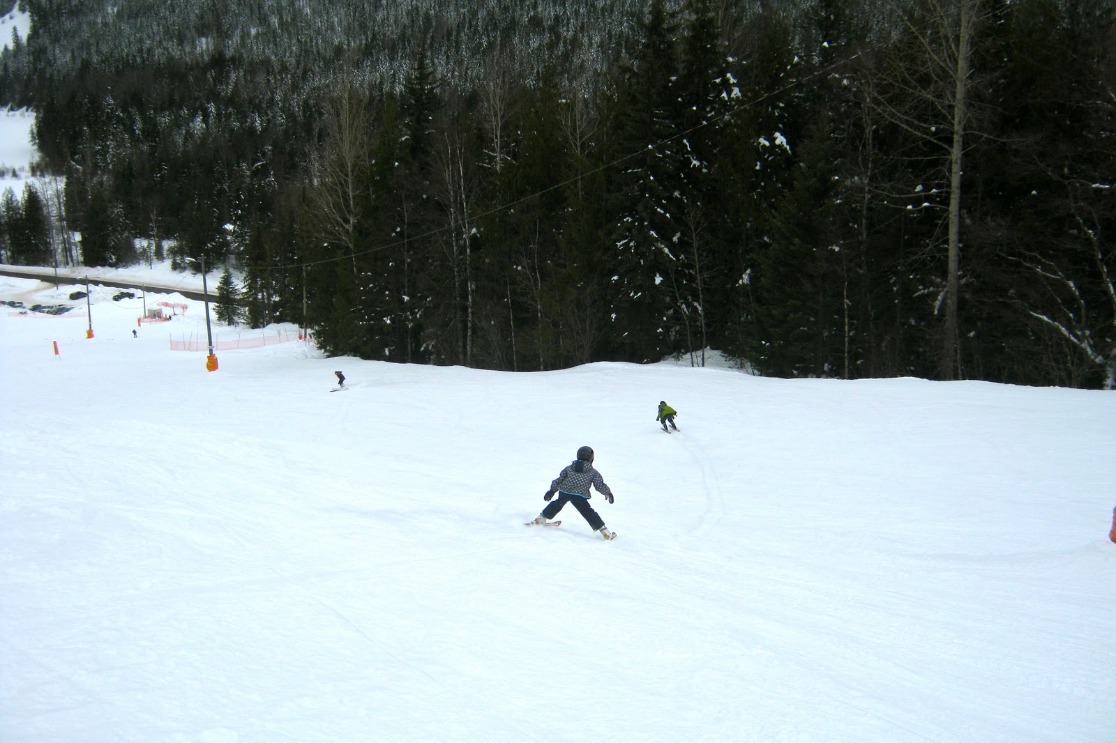
Putting perspective not on the size of the hill, or the view of the base area, but on the size of the operation. On a beautiful day in February with fabulous snow conditions and finger-and-toe-friendly temperatures, you can count nine cars in the parking lot, and the only four skiers you can see in this photo are the four I brought with me.
Thursday, February 10, 2011
Ski Hill View
Looking down on Summit Lake, which marks the northern end of the Slocan Valley, from part way down the southernmost easy ski run.
Subscribe to:
Posts (Atom)